Attractions to Visit

Image 1
Information

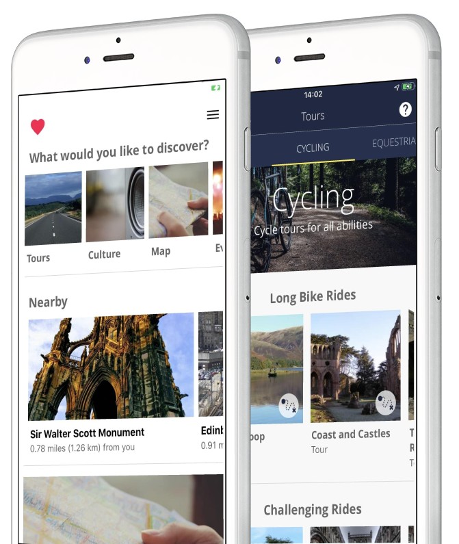
Download the visitor app

Information
Download the Scotland Starts Here app to discover the best of the South of Scotland on-the-go!
Image 1
Information

Solway Coast and Marine Project – Landscape Connections (SCAMP)

Information
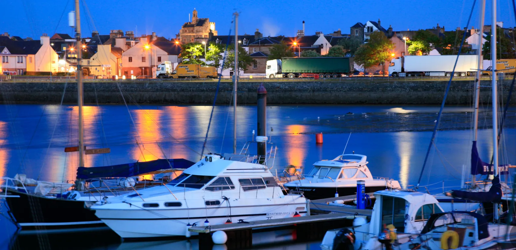
The Solway Firth is one of the largest and least industrialised estuaries in Europe, with a diverse marine ecosystem. Solway Coast and Marine Project – Landscape Connections (SCAMP) is an ambitious coastal and marine nature restoration project that seeks to restore the coastal and shallow sea habitats of the Solway, covering the entire 210 miles of the Dumfries and Galloway Coastline from Gretna to the Rhins of Galloway.
Image 1
Information

Stranraer Development Trust

Information
The Stranraer Development Trust was formed by a group of people who were concerned about the downturn of the town. The Trust received charitable status in February 2016 as a SCIO (Scottish Charitable Incorporated Organisation). The primary aims of the Trust are to achieve sustainable regeneration of the community of Stranraer addressing a range of economic, social, environmental and cultural issues.
Image 1
Information

Rhins of Galloway Visitor Information

Information
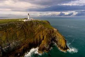
The Rhins of Galloway showcases a harmonious coexistence between nature and human activity, earning it UNESCO Biosphere status in July 2023. Nowhere is this more evident than at journey’s end, the Mull of Galloway, Scotland’s most southerly point. The area is an RSPB site with stunning views of wildlife, scenery and the rugged beauty of this peninsula.
Image 1
Cycling

The Kirkpatrick C2C, South of Scotland’s Coast to Coast

Cycling
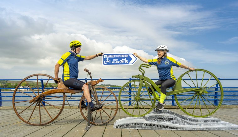
The Kirkpatrick C2C, South of Scotland’s Coast to Coast cycling route, celebrates the South of Scotland’s key role in the creation of the bicycle. The on-road route offers 250 miles of uninterrupted joy for experienced cyclists from Stranraer on the west coast to Eyemouth on the east coast. Almost 200 years ago Kirkpatrick Macmillan, a blacksmith from Dumfriesshire, created the first pedal-driven bicycle, the velocipede, an innovation that changed the world forever!
Image 1
Culture and Heritage+4

Kielder Salmon Centre

Culture and Heritage, Rivers and Lakes, Nature and Wildlife, Galleries and Museums, Accessible Activities
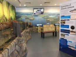
The incredible and unique life cycle of the salmon starts here! The Environment Agency’s Salmon Centre is the largest conservation Salmon hatchery in England and Wales. Visit the centre to learn all about why the Environment Agency raises thousands of young salmon to be released into the River Tyne - the country's most thriving salmon river. But that's not all you can see here! The Centre also rears fresh water pearl mussels, one of the UK's most endangered species, which you can see in our outdoor river system. Come here to: take a walk around the visitor centre to find out more about the fascinating life cycle of the Atlantic salmon and the work of the Salmon Centre. See the adult fresh-water pearl mussels living in our artificial stream and the trout that are a vital part of their fascinating lifecycle. Open daily from the start of April until the end of September.
Image 1
Rivers and Lakes+6

Kielder Waterside

Rivers and Lakes, Art & Architecture, Nature and Wildlife, Sites and Castles, Walks and Activities, Cycling, Accessible Activities
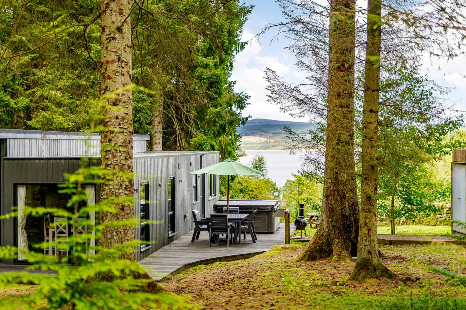
As well as a visitor hub in a scenic location, offering many things to see and do, Kielder Waterside is also a centre for staying guests. With panoramic views of the reservoir, this is the ideal base to recharge and refresh or take part in an action-packed day of activities. Facilities are open to both day visitors and onsite guests. Luxury lodge accommodation activities include; segways, archery, crazy carts, water walker and disc golf http://www.bookwhen.com/kielderwatersideactivities . Water activities include paddleboarding & canoeing, pleasure boat & fishing boat hire (seasonal), lakeside way & other trails, bike hire (seasonal), miniature golf, Indoor swimming pool, sauna & spa (pre-booking required), gift & essentials shop including fishing permits, tackle & outdoor wear, birds of prey centre, outdoor children’s play area & indoor soft play, art & architecture, human burrow, the Forest Bar & Kitchen Hide café, Osprey Ferry terminus - bookwhen.com/kielderwatersideferry, tipi weddings, toilets, disabled access, Kielder Waterside Caravan Park (seasonal) - to book your pitch please visit: www.bookwhen.com/kielderwatersidecaravanpark
Image 1
Culture and Heritage+5

Bowness on Windermere

Culture and Heritage, Rivers and Lakes, Nature and Wildlife, Galleries and Museums, Walks and Activities, History & Heritage
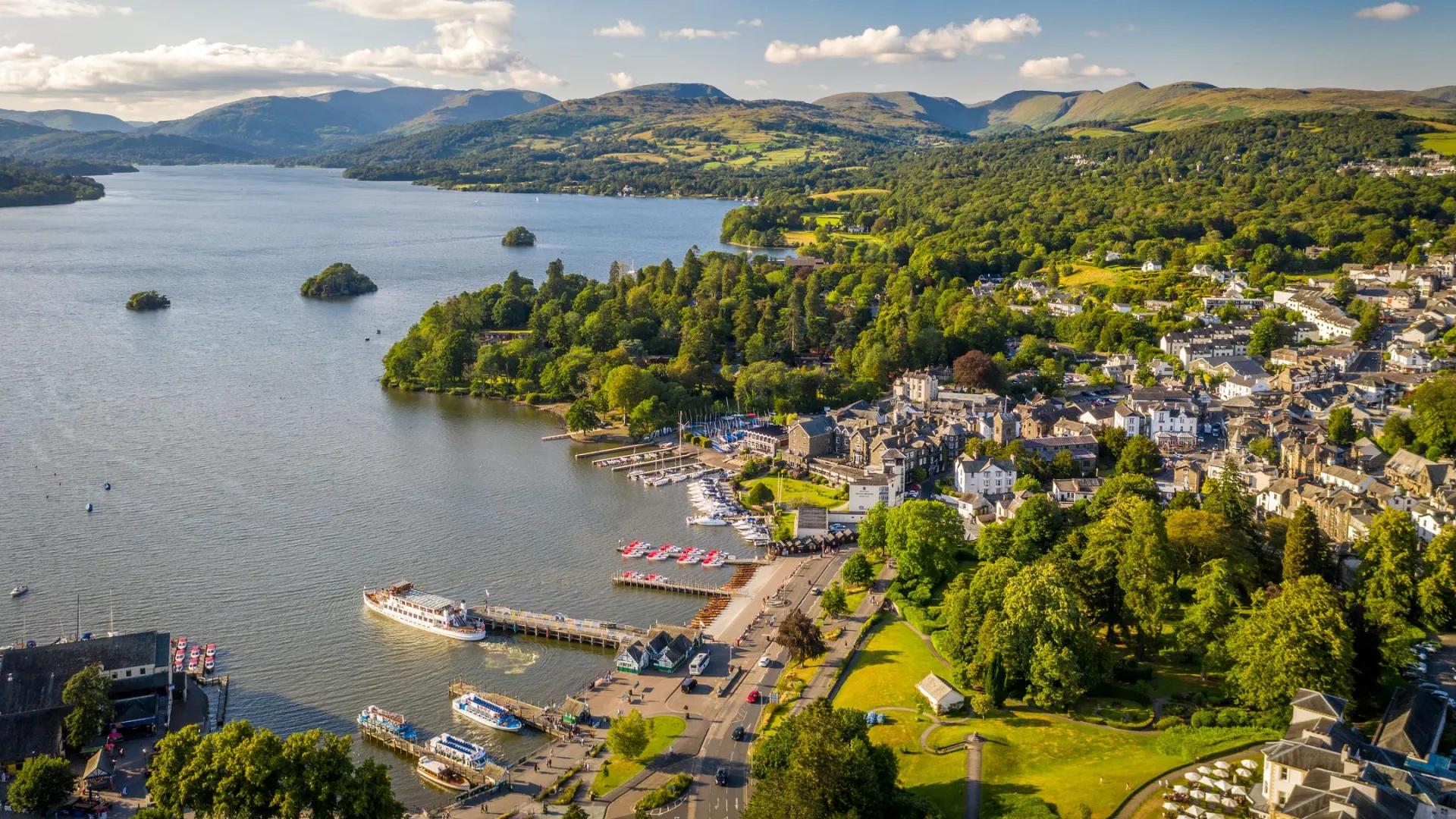
A small town on the shores of Windermere lake and the Lake District's most popular visitor destination.
Image 1
Walks and Activities

Rhins of Galloway Coastal Path

Walks and Activities
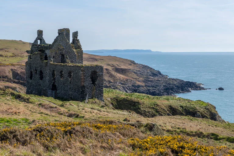
Explore the fantastic fringes of the Rhins peninsula on this 83-mile (133km) circular coastal trail. Enjoy the stunning scenery of Scotland’s south-west coast from the sheltered waters of Loch Ryan to the windswept cliffs of the Mull of Galloway.
Image 1
Rivers and Lakes+7

Kielder Castle

Rivers and Lakes, Art & Architecture, Nature and Wildlife, Sites and Castles, Walks and Activities, Hills and Mountains, Cycling, Accessible Activities
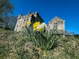
Overlooking the Kielder Burn and the North Tyne River before it enters Kielder Water, the Grade 2 listed castle was once a former hunting lodge of the Duke of Northumberland. It now serves as a family walking and cycling centre, forest exploration and discovery venue and the gateway to the largest network of mountain biking trails in England which include the Deadwater Trails, the new Deadwater Mile Down fast downhills and the new The Lonestar Trail which is suitable for adapted and 4-wheel bikes. Kielder Castle is also a start point for several walking and cycling trails including the Stickman Trail, Wallace & Gromit trails and the fabulous Lakeside Way. You can hire bikes at Kielder Castle, including e-bikes, trailers and other accessories from Team Cycles, located between the castle and parking area. In the castle location, you will also find artworks including Minotaur Maze. The castle is also the start/finish of the scenic 4x4 Forest Drive (to A68 & Redesdale). Near to Kielder Castle is the Kielder Salmon Centre, Kielder historic viaduct, Bakethin Nature Reserve and Kielder Campsite. Note that Kielder Castle Cafe is currently closed for renovations.
Image 1
Rivers and Lakes

River Tweed

Rivers and Lakes

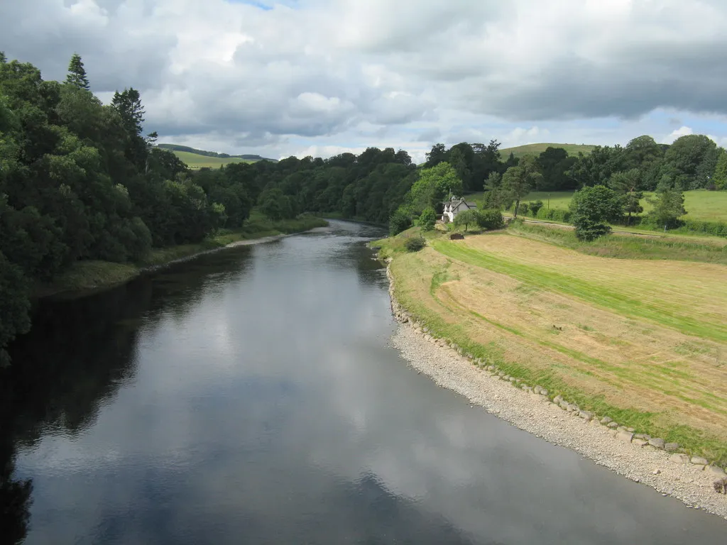
The River Tweed is a majestic waterway that has been an integral part of Scotland's history and culture for centuries. It flows through the beautiful Scottish Borders region, stretching for over 97 miles from its source in the Southern Uplands near Moffat, to its mouth at Berwick-upon-Tweed where it finally meets the North Sea. As one of the world's most iconic rivers, it has played a vital role in shaping Scotland's past and present. It was once a major trading route in medieval times, with ships carrying goods and people up and down the river. Its strategic location also made it a site of numerous battles during times of war between England and Scotland.
Image 1
Culture and Heritage+1

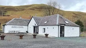
Crook Inn

Culture and Heritage, Sites and Castles
The Crook Inn has been at the heart of Tweedsmuir for more than 400 years. In 1604 it was one of three inns licensed under new laws introduced in Scotland by King James I/VI, to ’restrain the inordinate Haunting and Tippling of Inns, Alehouses, and other Victualling Houses’. In 1688 the local Minister was ousted by his congregation, who preferred the Covenanters. He took the key to the Kirk, so services were held in The Crook until the Kirk could be reopened. The next minister was ordained at the inn. It continued to offer hospitality to visitors and the community alike until its closure in 2006.
Image 1
Sites and Castles

Tweedsmuir Village Hall

Sites and Castles
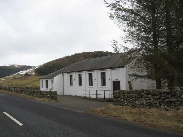
Tweedsmuir (Scottish Gaelic: Sliabh Thuaidh) is a village and civil parish in Tweeddale, the Scottish Borders Council district, southeastern Scotland. Geography The village is set in a valley, with the rolling hills and burns on both sides, covering some fifty square miles. It incorporates settlements at Hearthstane, Cockiland, Menzion, and Oliver. Tweedsmuir was in the historic county of Peeblesshire. It is situated 8 miles (13 km) from the source of the River Tweed. History James Hogg recorded that in 1620 a severe storm remembered as 'the thirteen drifty days' caused such severe sheep losses that a glen in Tweedsmuir owned by Sir James Montgomery was converted to a common grazing and remained as such for almost a century. Landmarks and features Oliver Castle was one of the local strongholds, and later country estates, of the Clan Tweedie family. The Parish Church of Tweedsmuir was built with Scottish red sandstone in 1874 on site of earlier 1643 structure. It is a Category B listed building. There are notable Tweedie gravestones in the parish churchyard. The Crook Inn is in the village, on the A701. It is one of many claimants to be the oldest inn in Scotland. It is where Robert Burns wrote "Willie Wastle's Wife". The 22 MW Glenkerie wind farm of Infinis is located five kilometres (three miles) northwest of the village. Talla Reservoir The Talla Reservoir is nearby. In 1894 the Edinburgh and District Water Trustees decided to build Talla as the new source of water for Edinburgh. The surface and the gradient of the main road were unsuitable for carting the quantities of material that would be needed for the new reservoir, so the Talla Railway was built from Broughton to Talla. While work on the railway and the reservoir was in progress, a large number of workmen lived in Tweedsmuir, dramatically increasing the population. The valve-closing ceremony was held at Talla on 20 May 1905, and on 28 September, when the reservoir was about two-fifths full, there was an inaugural ceremony. The large company was brought from Edinburgh in two special trains, which were hauled for the last stage of the journey, from Broughton Station, by small service engines on the Talla railway.
Image 1
Rivers and Lakes+1

Windermere Ferry

Rivers and Lakes, Nature and Wildlife
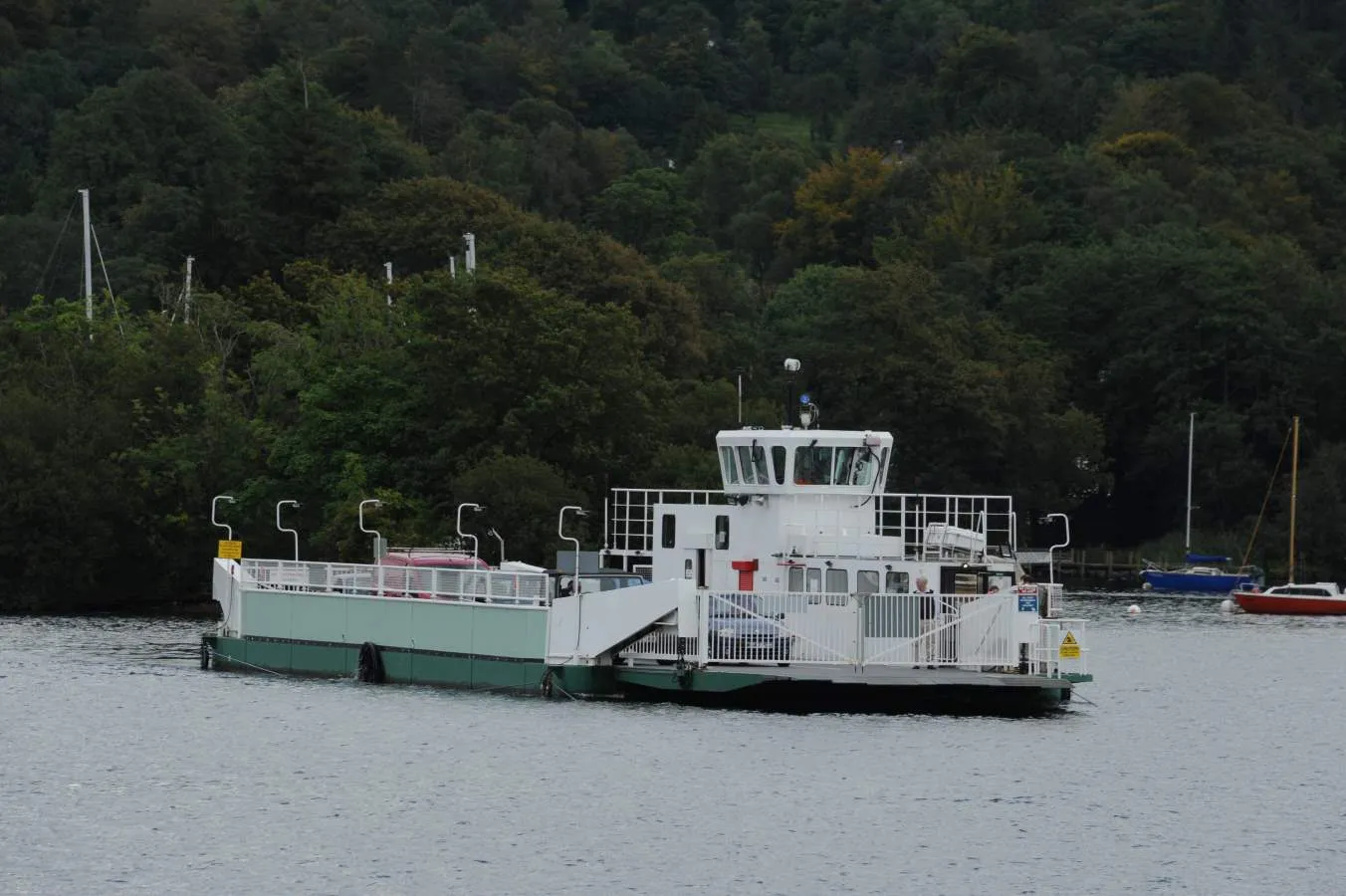
The Windermere Ferry is a vehicular cable ferry which crosses Windermere, the largest lake in England and located within English county of Cumbria. The ferry route forms part of the B5285 road and crosses the lake at about its midpoint, from Ferry Nab in Bowness-on-Windermere to Ferry House at Far Sawrey, a distance of some 490 metres (540 yd). The ferry is owned and operated by Westmorland and Furness Council. The ferry operates all year, with services every 20 minutes from early morning to mid-evening. Each crossing can carry up to 18 cars and over 100 passengers and takes less than 10 minutes. A toll is charged. If the ferry is not operating, the alternative is a road journey of approximately 15 miles (24 km) around either the head or foot of the lake. The historic county boundary between Lancashire and Westmorland runs down the western shore of the lake and also along about three miles (5 km) of the southern section of the eastern shore. Anyone crossing the lake from east to west on the Windermere Ferry thus travels from the historic county of Westmorland to that of Lancashire.
Image 1
Rivers and Lakes+2

Broad Law

Rivers and Lakes, Art & Architecture, Nature and Wildlife
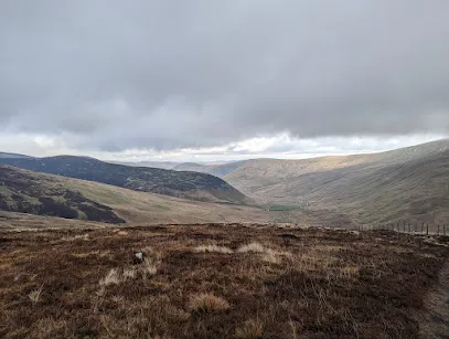
Broad Law is the highest hill in the Scottish Borders at 840m. Its gently mossy slopes are topped with the highest air traffic beacon in the UK. There are a few route options to access the summit of Broad Law. This is an out and back route starting just off of the A701 at Hearthstanes where the distinctive steel bridge spans the River Tweed. An alternative circular route could be taken which finishes at the Megget Stone on the Talla/Cappercleugh road. This description is only for the out and back route. Start/Parking There is parking in a layby just off the A701 next to the bridge. Please park considerately. There is also parking at the Crook Inn which involves walking along the A701 carriageway. All usual care and consideration should be taken when walking on public highways. The route is predominantly on gravel forestry roads and enables access for vehicles and personnel who need to maintain and service the radio beacon. Please be aware that there may be vehicles on this route at any time. This walk is approximately 7 miles/11km, taking 4 to 5 hours depending on fitness of the party and weather conditions. It is very pleasant walk in good weather, but the summit can resemble an Arctic landscape in winter conditions. Please dress appropriately and ensure you have the necessary equipment and skills to have a safe trip on the hills. Take the tarmac single-track road across the bridge and continue through the farmyard at Hearthstanes. The route takes a dog-leg (left and then right) as the track starts to rise gently, passing sheepfolds before picking up the track beyond the farmyard. Gates should be left as found. This is a working farm so please ensure dogs are always kept on leads. Continue heading east along the main track which then heads south east as it runs parallel with Hearthstanes Burn. Stay on the main track as it emerges from forestry into more open hillside. Again, continue on this track as it rises more steeply up the slopes of Broad Law. As you approach the summit the gradient eases and the distinctive shape of the radio beacon will be visible. This can be a very handy reference point in poor visibility. Almost due south of the beacon sits the summit cairn. If you go past the beacon heading south east, you will find a stob and wire fence which could be used as a handrail and followed in a south westerly direction to reach the cairn. With good visibility, the panoramic views on offer are unsurpassed in the area. The route homewards is a reverse of your outward route.
Image 1
Rivers and Lakes+2

Carlowse Bridge

Rivers and Lakes, Nature and Wildlife, Walks and Activities

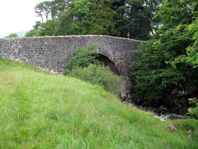
Carlowse Bridge was built in 1783, replacing an earlier bridge erected sometime between 1694 and 1741. The bridge was a Category C listed structure until the renovation work that Scottish Borders Council carried out in 2012. The bridge became an important crossing point of the Tweed. Before it was built, the only access to the Kirk had been via a ford and stepping stones near the current Kirk site. The small waterfall above the Bridge is named Carlow’s Linn, and the current bridge name has evolved from the original Carlow’s Brig. It is possible that the word ‘carlow’ comes from the old Scots word ‘carlin’, which is a disparaging term for an old woman: a witch. The falls may originally have been named Witches Linn, and the bridge, Witches Brig. The River Tweed rises at Tweed Wells, in the Lowther Hills in Tweedsmuir just before the boundary to Dumfries and Galloway. Both the River Annan and the Clyde rise near to Tweed Wells, heading in opposite directions. The Tweed is 97 miles/156km long, and flows east across the Scottish Borders before it meets the sea at Berwick-upon-Tweed, just across the border with England. The Tweed drops 1550 ft/472m from source to sea, and a half of this drop occurs in its first 20 miles.
Prev1 2