Tweedsmuir

Live weather for this venue,
including today’s conditions.
Tweedsmuir, GB
13°
Cloudy
4:55 am9:44 pm BST
Feels like: 12°C
Wind: 6km/h NNE
Humidity: 76%
Pressure: 1019.98mbar
UV index: 0
SatSunMonTueWed
19°C / 6°C
20°C / 10°C
21°C / 10°C
21°C / 11°C
20°C / 11°C

Attractions to Visit

Image 1
Rivers and Lakes

River Tweed

Rivers and Lakes

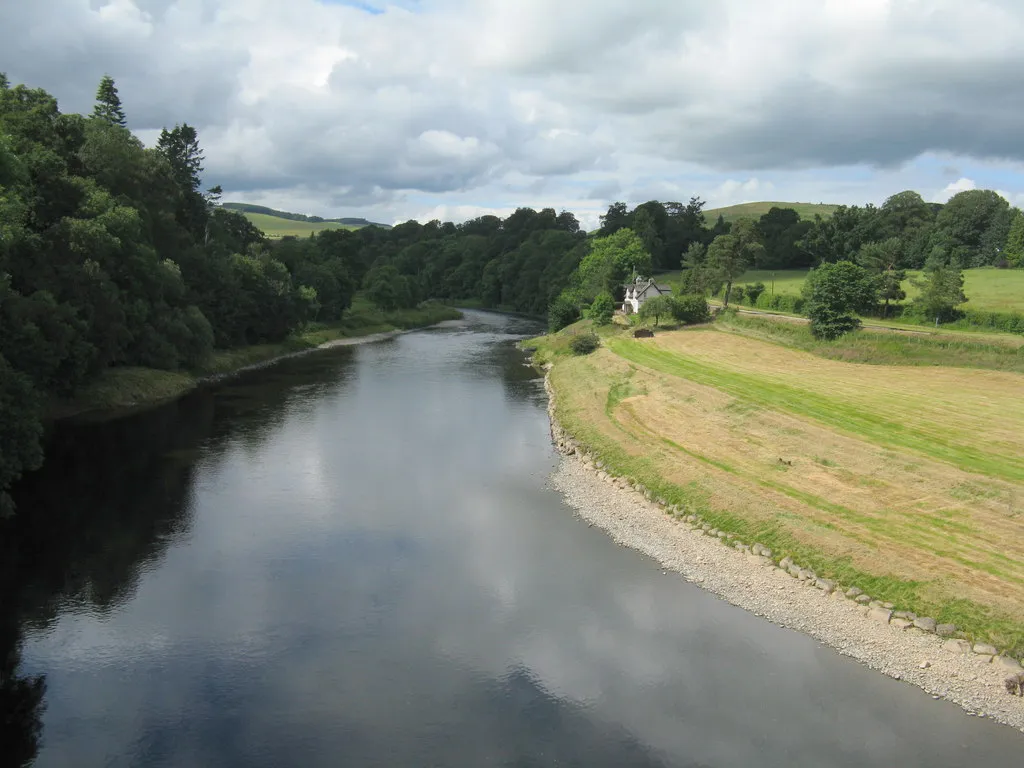
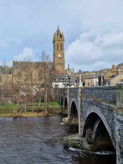
The River Tweed is a majestic waterway that has been an integral part of Scotland's history and culture for centuries. It flows through the beautiful Scottish Borders region, stretching for over 97 miles from its source in the Southern Uplands near Moffat, to its mouth at Berwick-upon-Tweed where it finally meets the North Sea. As one of the world's most iconic rivers, it has played a vital role in shaping Scotland's past and present. It was once a major trading route in medieval times, with ships carrying goods and people up and down the river. Its strategic location also made it a site of numerous battles during times of war between England and Scotland.
Image 1
Culture and Heritage+1

Crook Inn

Culture and Heritage, Sites and Castles

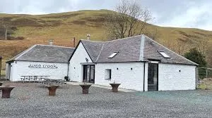
The Crook Inn has been at the heart of Tweedsmuir for more than 400 years. In 1604 it was one of three inns licensed under new laws introduced in Scotland by King James I/VI, to ’restrain the inordinate Haunting and Tippling of Inns, Alehouses, and other Victualling Houses’. In 1688 the local Minister was ousted by his congregation, who preferred the Covenanters. He took the key to the Kirk, so services were held in The Crook until the Kirk could be reopened. The next minister was ordained at the inn. It continued to offer hospitality to visitors and the community alike until its closure in 2006.
Image 1
Sites and Castles

Tweedsmuir Village Hall

Sites and Castles

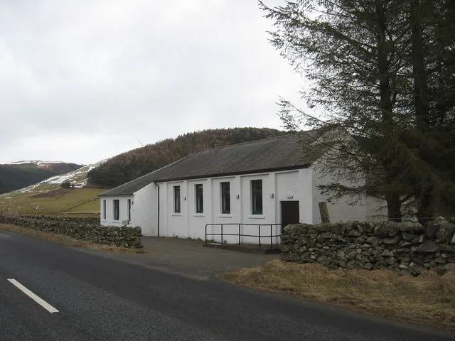
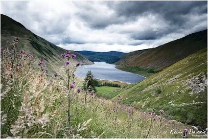
Tweedsmuir (Scottish Gaelic: Sliabh Thuaidh) is a village and civil parish in Tweeddale, the Scottish Borders Council district, southeastern Scotland. Geography The village is set in a valley, with the rolling hills and burns on both sides, covering some fifty square miles. It incorporates settlements at Hearthstane, Cockiland, Menzion, and Oliver. Tweedsmuir was in the historic county of Peeblesshire. It is situated 8 miles (13 km) from the source of the River Tweed. History James Hogg recorded that in 1620 a severe storm remembered as 'the thirteen drifty days' caused such severe sheep losses that a glen in Tweedsmuir owned by Sir James Montgomery was converted to a common grazing and remained as such for almost a century. Landmarks and features Oliver Castle was one of the local strongholds, and later country estates, of the Clan Tweedie family. The Parish Church of Tweedsmuir was built with Scottish red sandstone in 1874 on site of earlier 1643 structure. It is a Category B listed building. There are notable Tweedie gravestones in the parish churchyard. The Crook Inn is in the village, on the A701. It is one of many claimants to be the oldest inn in Scotland. It is where Robert Burns wrote "Willie Wastle's Wife". The 22 MW Glenkerie wind farm of Infinis is located five kilometres (three miles) northwest of the village. Talla Reservoir The Talla Reservoir is nearby. In 1894 the Edinburgh and District Water Trustees decided to build Talla as the new source of water for Edinburgh. The surface and the gradient of the main road were unsuitable for carting the quantities of material that would be needed for the new reservoir, so the Talla Railway was built from Broughton to Talla. While work on the railway and the reservoir was in progress, a large number of workmen lived in Tweedsmuir, dramatically increasing the population. The valve-closing ceremony was held at Talla on 20 May 1905, and on 28 September, when the reservoir was about two-fifths full, there was an inaugural ceremony. The large company was brought from Edinburgh in two special trains, which were hauled for the last stage of the journey, from Broughton Station, by small service engines on the Talla railway.
Image 1
Rivers and Lakes+2

Broad Law

Rivers and Lakes, Art & Architecture, Nature and Wildlife

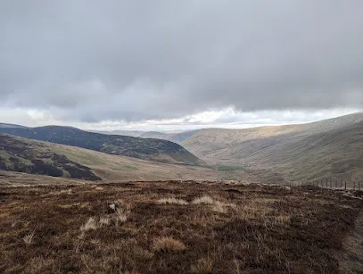
Broad Law is the highest hill in the Scottish Borders at 840m. Its gently mossy slopes are topped with the highest air traffic beacon in the UK. There are a few route options to access the summit of Broad Law. This is an out and back route starting just off of the A701 at Hearthstanes where the distinctive steel bridge spans the River Tweed. An alternative circular route could be taken which finishes at the Megget Stone on the Talla/Cappercleugh road. This description is only for the out and back route. Start/Parking There is parking in a layby just off the A701 next to the bridge. Please park considerately. There is also parking at the Crook Inn which involves walking along the A701 carriageway. All usual care and consideration should be taken when walking on public highways. The route is predominantly on gravel forestry roads and enables access for vehicles and personnel who need to maintain and service the radio beacon. Please be aware that there may be vehicles on this route at any time. This walk is approximately 7 miles/11km, taking 4 to 5 hours depending on fitness of the party and weather conditions. It is very pleasant walk in good weather, but the summit can resemble an Arctic landscape in winter conditions. Please dress appropriately and ensure you have the necessary equipment and skills to have a safe trip on the hills. Take the tarmac single-track road across the bridge and continue through the farmyard at Hearthstanes. The route takes a dog-leg (left and then right) as the track starts to rise gently, passing sheepfolds before picking up the track beyond the farmyard. Gates should be left as found. This is a working farm so please ensure dogs are always kept on leads. Continue heading east along the main track which then heads south east as it runs parallel with Hearthstanes Burn. Stay on the main track as it emerges from forestry into more open hillside. Again, continue on this track as it rises more steeply up the slopes of Broad Law. As you approach the summit the gradient eases and the distinctive shape of the radio beacon will be visible. This can be a very handy reference point in poor visibility. Almost due south of the beacon sits the summit cairn. If you go past the beacon heading south east, you will find a stob and wire fence which could be used as a handrail and followed in a south westerly direction to reach the cairn. With good visibility, the panoramic views on offer are unsurpassed in the area. The route homewards is a reverse of your outward route.
Image 1
Rivers and Lakes+2

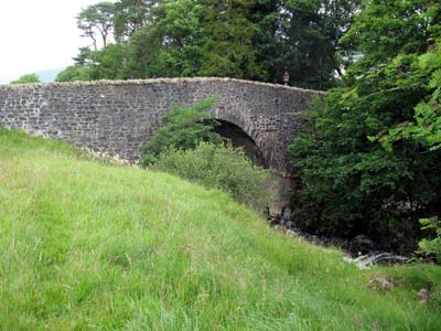
Carlowse Bridge

Rivers and Lakes, Nature and Wildlife, Walks and Activities

Carlowse Bridge was built in 1783, replacing an earlier bridge erected sometime between 1694 and 1741. The bridge was a Category C listed structure until the renovation work that Scottish Borders Council carried out in 2012. The bridge became an important crossing point of the Tweed. Before it was built, the only access to the Kirk had been via a ford and stepping stones near the current Kirk site. The small waterfall above the Bridge is named Carlow’s Linn, and the current bridge name has evolved from the original Carlow’s Brig. It is possible that the word ‘carlow’ comes from the old Scots word ‘carlin’, which is a disparaging term for an old woman: a witch. The falls may originally have been named Witches Linn, and the bridge, Witches Brig. The River Tweed rises at Tweed Wells, in the Lowther Hills in Tweedsmuir just before the boundary to Dumfries and Galloway. Both the River Annan and the Clyde rise near to Tweed Wells, heading in opposite directions. The Tweed is 97 miles/156km long, and flows east across the Scottish Borders before it meets the sea at Berwick-upon-Tweed, just across the border with England. The Tweed drops 1550 ft/472m from source to sea, and a half of this drop occurs in its first 20 miles.
Image 1
Culture and Heritage+2

Logan Iron Age Fort

Culture and Heritage, Sites and Castles, Walks and Activities

A walk back in time, describing the lives of the people who have lived in the Logan Valley for centuries. The Iron Age Fort, later dwellings and other archaeological features of interest are explained as you walk through the hills. It is fascinating to stand where Tweedsmuir residents lived centuries ago, and see the mark they made on the landscape. This walk takes you across rough grassland, open heather hills and includes several steep climbs and descents. There are no clearly defined paths, as the walk takes you along sheep tracks, old drove roads and rough terrain at the furthest end of the walk. Some parts are boggy, and you will walk though areas of heather. The walk up Worm Hill is steep and challenging. There are 4 pedestrian gates on the route. You can choose to split the walk at the bridge over the Logan Burn, making a much easier route.
Image 1
Culture and Heritage+1

Patervan Path

Culture and Heritage, Galleries and Museums

This is a beautiful walk within sight of the River Tweed, and then along one its tributaries, Polmood Burn. You should be able to glimpse plenty of wildlife, including red squirrels, buzzards, hares and maybe even a golden eagle. At the end of the walk the landscape opens up to give spectacular views of some of the highest hills in the Borders, including Broad Law. This walk takes you along well-maintained, coarse gravel farm tracks. The route is way marked by yellow arrows on small green circular signs. You follow a well-made track up the valley and then through the grassland in Polmood Valley. There are options to extend this walk, and you should consult an OS map to plan your walk if you wish. There is a cattle grid with a pedestrian gate, and several gates to go through, which should all be left as you find them.
Image 1
Culture and Heritage+2

Top of Talla Linns

Culture and Heritage, Rivers and Lakes, Walks and Activities

Start/Parking: There is a car parking area near the start of this walk just after you cross the small bridge (if coming from Tweedsmuir), round the corner on the left-hand side of the road. The first part of the walk is on a reasonable track, although some areas are muddy and there are loose stones along the way. After the green shed, the path becomes a bit less defined and boggy. Towards the end of the track you will have to cross a burn, and there is no bridge, and avoid the wetter areas of the path. This final section requires stout footwear and a good level of fitness. Talla Linns is the name of the waterfall that cascades impressively down the hillside. The road here is also known as ‘The Linns’ locally, and is a steep single-track section that often takes visitors to the area unawares. It is untreated through the winter months, making access impossible during the snowy and frosty periods. A very impressive Victorian drainage gully runs down the side of the road. This was cleared and restored by a local volunteer in 2010, and has resulted in much safer driving conditions.

Overview

Total Visitors: 0
Total Visitors: 0